
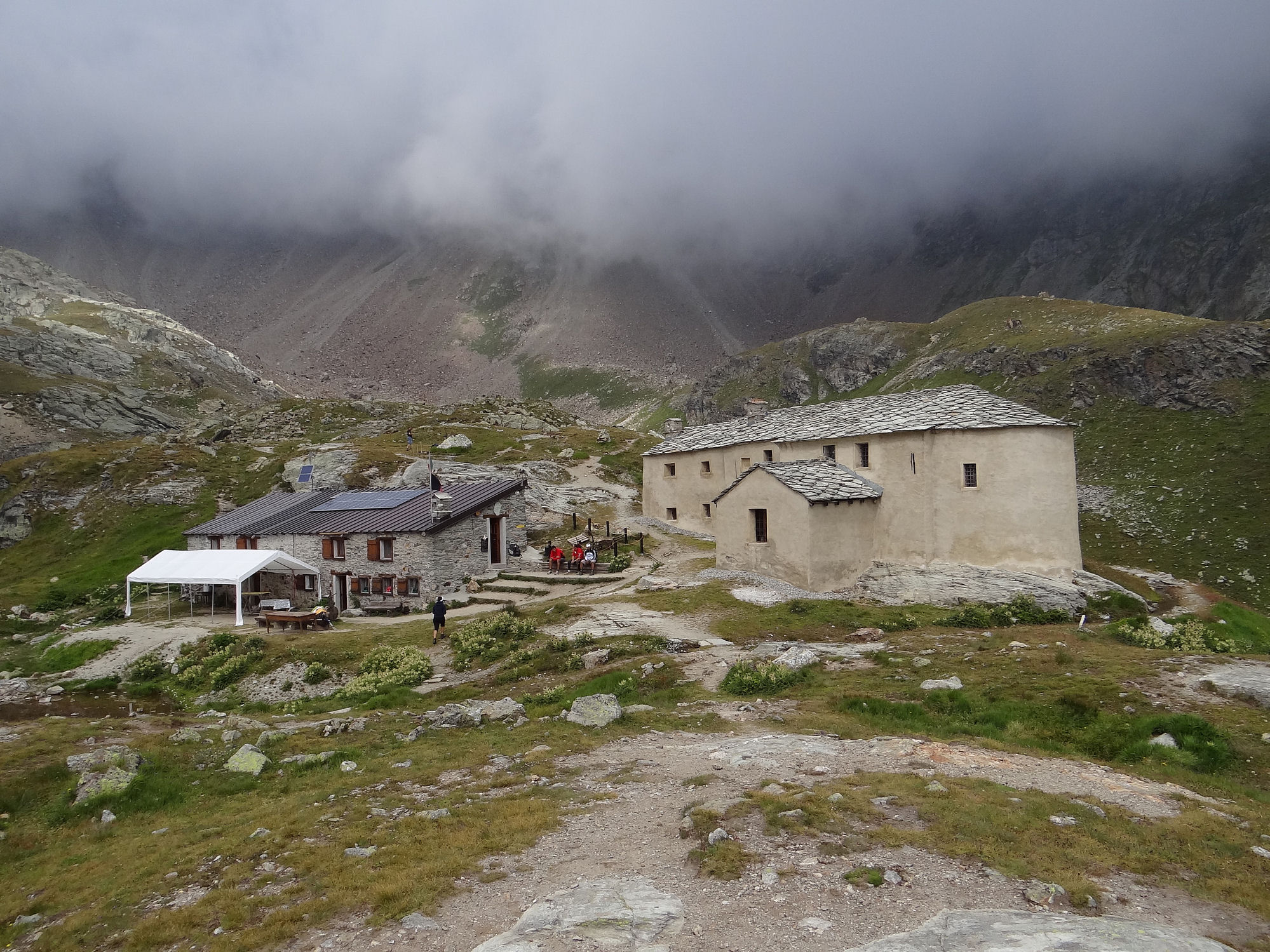
Sanctuary of Cuney
The Cuney Sanctuary is one of Europe's highest places of worship, known for its picturesque location and spiritual significance. The sanctuary attracts visitors and pilgrims seeking peace and reflection in a serene and inspiring environment.
The sanctuary can be visited from spring to autumn.
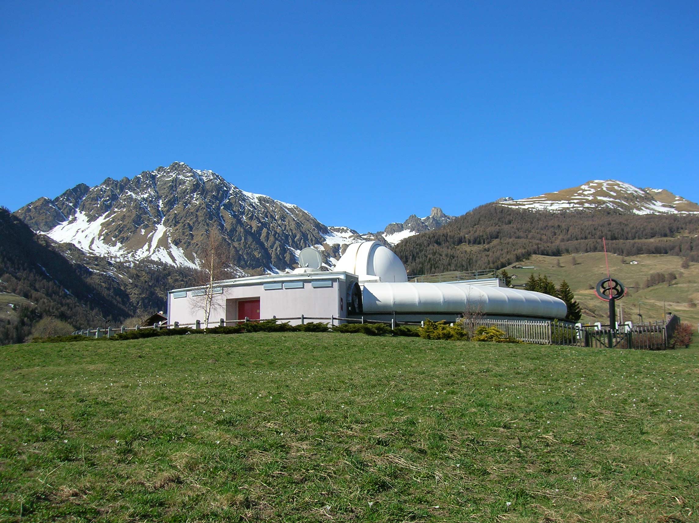
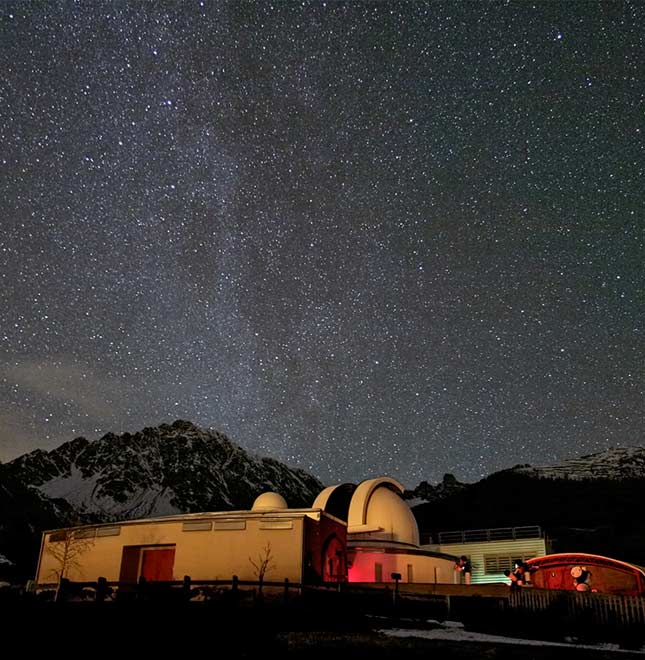
Astronomical Observatory
The Astronomical Observatory is a must-see attraction offering visitors a unique opportunity to explore the stars and the universe. Ideally located for observing the sky, the observatory is a point of reference for astronomy enthusiasts.
Attraction available all year round.
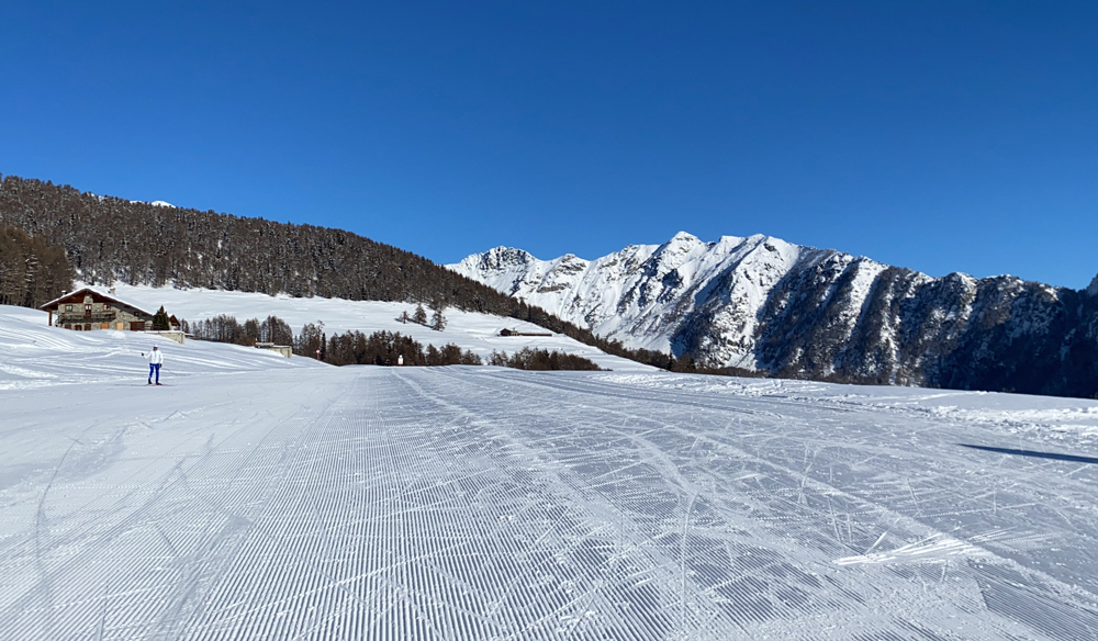
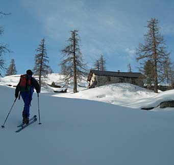
Cross-country ski itinerary
Located in Praz de l'Arp, at an altitude of 1,960 metres, the cross-country ski tack is a true paradise for cross-country skiers, with 30 km of trails and breathtaking panoramic views.
Attraction available during the winter months.
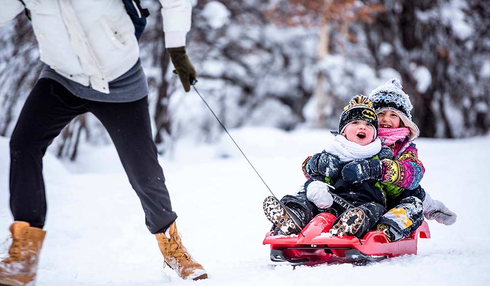
Funpark
The Saint-Barthélemy Funpark, located in the new Praz de l'Arp Nordic ski centre at an altitude of 1,960 metres, is an ideal destination for families. With its 120-metre conveyor belt, it's a safe and enjoyable introduction to skiing for beginners. The park also has a dedicated raft and bobsleigh run, perfect for hours of fun on the snow.
Attraction available during the winter months.
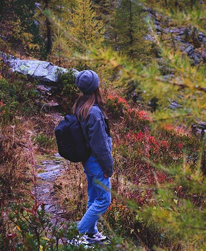
Itinerary 1: La Pesse-Joux loop
- Duration: 3 hours round trip
- Elevation gain: +221 m (+ = positive difference in altitude)
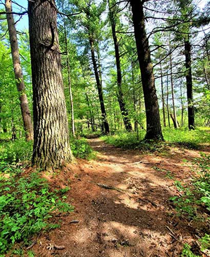
From La Pesse, reach the Joux mountain pasture, follow a path through the Boure forest, arrive at La Boure and descend to Pesse.
The first part of the route takes you through a beautiful spruce forest, before arriving at the Joux mountain pasture in an enchanting and totally secluded clearing. Here, in late spring and summer, you can admire the blossoming of the region's classic millefiori and
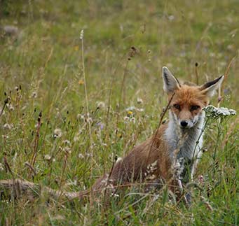
it's not unusual to come across or spot deer or roe deer grazing.
Continuing on, approach Alpe La Boure, where you can see a noticeable change in the forest: the spruce forest is gradually giving way to Scots pine, and the mountain is more south-facing, with more sunshine and less damp soil.
From here, there is a remarkable panoramic view over the central valley of the region.
On the way back, you pass a number of pastures where herds of cows from the Aosta Valley, the pezzata nera and the pezzata rossa cattle, graze in June and September.
Itinerary 2: La Pesse-Lignan loop
- Duration 4h30 round trip
- Elevation gain: +298 m
From La Pesse, take path no. 3 through the Bois de Val to the hamlet of Les Fabriques, then take path no. 4 up to the hamlet of Lignan. The return journey takes the same route.
For around twenty minutes, the path follows a farm track, then a path through a spruce forest, almost entirely downhill, which leads to the bottom of the Saint Barthélémy valley, near the hamlet of Les Fabriques. This was once a wood storage area and a place where ore from the mines above the village was fired. From here, the path continues to climb towards the picturesque village of Lignan.
The first part of the trail passes through a forest dominated by Scots pine and juniper, while the second part is dominated by larch and spruce.
The last part of the trail crosses vast pastures where haymaking is still practised.
The village of Lignan boasts a hotel, a hostel, a restaurant, THE ASTRONOMICAL OBSERVATORY AND THE PLANETARIUM.
In the centre of the village stands the church, built in the 12th century, while at the far end, on a promontory facing the Baita La Pesse, stands an ancient "castelliere" dating from the Iron Age.
Itinerary 3: La Pesse-Col de Filon
- Duration: 4h30 return
- Elevation gain: +330 m
From La Pesse, join the Joux mountain pasture, arrive at the Col du Filon, descend along a farm track and skirt a marble quarry at Verrayes. At the end of the descent, continue along another level farm track to the La Boure mountain pasture, then descend towards La Pesse.
Following a mule track through the forest, dominated by spruce trees, you reach Alpe Joux. In late spring, in the clearing below, you can admire a spectacular flowering.
Then reach the Col Filon, an unspoilt spot where you are immersed in the wildest nature and where it is easy to spot deer, roe deer and even a few wild boar, all completely harmless.
In late summer and autumn, weather permitting, the forest is rich in mushrooms, in particular the much sought-after porcini mushrooms.
Once past the Col di Filon, the forest changes in appearance, as you head south, the Scots pine appears as tall vegetation and in the undergrowth you can admire a thick cover of bearberry.
Leaving the pass and after a short descent, you come to the Verrayes marble quarries, which are still in use.
From here, you can see the charming village of Vencorère in the municipality of Verrayes; if you take the farm track, you can still see the old copper mine dating back to Roman times on the ridge.
Then, you reach the La Boure mountain pasture, from where a rapid, even steep descent through pastures and forests leads back to the Baita La Pesse.
Itinerary 4: La Pesse-Vencorère
- Duration: 5 hours round trip
- Elevation gain: +304 m
Leave La Pesse on the farm track that leads to the village of Les Grangettes; from there, take a track that leads to the village of Vencorère. From there, walk into the woods leading to the Col du Filon and take the farm track leading to the Boure mountain pasture, then continue to La Pesse.
From the Baita La Pesse, head east along the municipal road, and after a few hundred metres of descent, where the road bends sharply, take the fork to the hamlet of Les Grangettes. Here you find yourselves on a spectacular balcony that affords sweeping views over much of the central Valle d'Aosta Valley. The slope faces south, so the climate is generally dry, hence the presence of Scots pine trees. This is the preferred habitat of roe deer, hares and rock partridges.
After passing the small village of Grangettes, take a path through an area where the forest has been devastated by a massive fire, before reaching a spruce grove at the end of which stands an old mill. After a short walk, you reach the picturesque village of Vencorere, surrounded by green meadows that benefit from the presence of plenty of water, as evidenced by the many fountains. In the village, you can admire the beauty of a community oven still in use, where rye bread is baked.
At this point, set off again in the direction of Col Filon; after crossing the Prala' mountain pasture, enter a forest of Scots pines, skirt a marble quarry and see in the distance the remains of an old copper mine dating back to Roman times.
In the undergrowth, the combination of bearberry and juniper is particularly interesting. Once you reach the Col Filon, you are on the northern slopes of the Saint Barthélémy valley, taking a forest track through a spruce forest that leads to the clearing of the Joux mountain pasture, where it is not uncommon to spot wild boar or even roe deer. From the Joux mountain pasture, continue on a path that enters the forest and then joins the farm track that takes you back to La Pesse.
Itinerary 5: La Pesse-Becca d'Aver
- Duration: 8h round trip
- Elevation gain: +986 m
From La Pesse, arrive to the Joux mountain pasture and reach the Col du Filon. From La Pesse, arrive to the Joux mountain pasture and reach the Col du Filon. If you wish, you can reach (with an extra 30 minutes) the summit of Longhede, which offers a breathtaking panorama of the whole central part of the Aosta Valley. From here, you start to descend along trail no. 1/2/6 until you arrive above the village of Vencorère. From here, walk to the Col du Filon and take the path that leads to the La Boure mountain pasture and then down to La Pesse.
Set off along the farm road to La Pesse, then take the path through a spruce forest to the richly flowered meadows of Alpe Joux. Continue on a forest track as far as Col Filon. At the pass, continue east on another forest track, then take a fairly level path that goes deep into the spruce-larch forest. This is a very wild area; the lack of human habitation means that animals such as deer and wild boar are easy to spot.
At one point the path crosses the Becca d'Aver and here the path climbs, entering a forest dominated by larches. It's easy to come across a few roe deer which, because their stomachs are smaller than those of other ungulates, are obliged to eat more frequently and therefore make themselves more visible.
This leads to what is known as an ecotone, the transition from larch forest to alpine meadow. This change in flora can also lead to a change in fauna: at this altitude, it is possible to spot chamois, hear the whistle of the marmot or notice the golden eagle circling in the sky.
The view from here is breathtaking, taking in the Saint Barthélémy valley and the entire centre of the Aosta Valley.
This is an area characterised by a total lack of water, so it's advisable to take along a good supply of liquids.
After reaching the summit, return to the opposite side of the walk, in the municipality of Verrayes.
First pass through a beautiful larch forest, then gradually reach a Scots pine forest, as the slope faces south. On the way down, you pass abandoned marble quarries, then join the track below Col Filon, then the La Boure mountain pasture, before descending to Pesse.
Itinerary 6: La Pesse-Becca d’Aver-Col Fenêtre
- Duration: 9 hours round trip
- Elevation gain: + 1032 m
Leaving the village of La Pesse, climb to the Joux mountain pasture and arrive at the Col du Filon. Here, continue through the Lavanchers forest on a path until you cross path no. 16 which goes up towards Becca d'Aver. From there, take trail no. 9 which leads to Col Fenètre. This trail is very picturesque and runs along a long ridgeline with passages equipped with chains to continue safely. From Col Fenètre, take path no. 17 which crosses the Bois de Praz Crou. This trail is all downhill, before arriving at a flat track marked trail no. 5. At the end of the long flat, join trail no. 16 of Becca d'Aver, and climb for 40 minutes passing through the Bois de Lavanchers. Arrive at the Col du Filon, go down towards the Joux mountain pasture and continue towards La Pesse.
Until the Becca d'Aver, the route follows that indicated by number 5. 5.
From the Becca d'Aver, take a beautiful, very panoramic path which follows the crest of the mountain and which, in certain places, is equipped chains as handrails. It leads to Col Fenetre. The place is impermeable, with the presence of rocks and small stones, a typical environment for ibexes, and if you are lucky, it is not certain that you will not spot a few specimens.
From Col de Fenetre, begin the descent on the slope which dominates the valley of Saint Barthélémy until crossing a fairly flat agricultural path, and even in this section it is easy to encounter chamois and deer. Then, join the path which leads to Becca d'Aver. The forest changes again, larches and spruces reappear. This is an excellent place to observe gurnard and hazel.
After a short climb, return to the flat path of the outward route, resuming the first part of the route towards Col Filon, Alpe Joux and finally the Baita la Pesse.
Itinerary 7: La Pesse-Pierrey-Praz
- Duration: 10 hours round trip
- Elevation gain: + 748 m
From the village of La Pesse, go up to the Joux mountain pasture and arrive at the Col du Filon. You then cross the Lavanchers forest until you come across trail no. 16. Go down for 30 minutes and continue on path no. 5 which crosses the Fontanes woods and the Praz Crou woods. You arrive at the Praz Crou alpine pasture and continue for 30 minutes to reach the Pierrey alpine pasture. At this point, take path no. 12, pass near the Vallorsière mountain pasture and reach the hamlet of Praz. There, take path no. 16, go down for 20 minutes and cross the St-Barthélemy stream, where there is an old mill and an old oven, then take the climb towards the Becca d'Aver. At an altitude of 2,000 meters, take the flat path which crosses the Lavanchers woods and heads towards the Col de Filon. At this point, we descend towards the Joux mountain pasture and finally cross the Bois de Val to reach the Baita La Pesse.